Watch Duty Adds Nationwide Flood Tracking to App, Months After Planned January 2025 Launch
The nonprofit expanded its disaster-monitoring service nationwide and introduced flood alerts using data from federal agencies and river buoys.
 nbcnews.com
Watch Duty, a nonprofit disaster-monitoring app, added nationwide flood tracking after expanding from its original focus on California wildfires. S. Geological Survey, and the National Oceanic and Atmospheric Administration into a single interface.
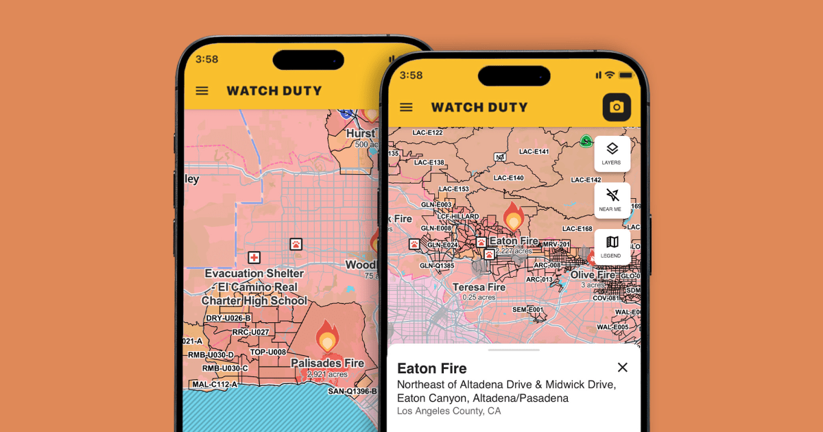
John Mills, Watch Duty’s CEO, said the organization had planned to begin flood integration in January 2025 but delayed the work after the Palisades and Eaton fires struck Los Angeles later that year. Since those fires, the app has doubled its staff and leadership headcount and attracted thousands of new users.
The app already provided real-time fire movement updates during the 2025 Los Angeles fires and formed a partnership with Amazon’s Ring cameras that allows nearby users to share video footage.
Org to develop AI tools that automatically transcribe emergency radio traffic during wildfires. Flood tracking relies on river buoys that measure water height. Users can now locate the nearest buoy and set push notifications for rising levels that indicate potential flooding.
Mills said the service will present floodplain locations and water levels without attempting to track every tree or minor obstruction. Mills noted that floods generally allow more advance warning than wildfires because water movement follows more predictable paths. He said the goal is to combine multiple agency reports so residents receive one clear picture rather than scattered alerts.
Watch Duty will continue to limit its coverage to natural disasters and will not monitor police radio channels for crime-related incidents. Mills said the organization intends to add other natural hazards over time, including events involving lava or wind.